
[ad_1]
The scale of the destruction left by Hurricane Melissa as it tore across Jamaica is now being revealed by the first photos taken by satellites.
The eye of the storm made landfall on the southwest coast of the island, 75 miles from the capital Kingston, on Tuesday.
Before and after images from Vantor’s satellites show the impact of the 185mph winds on the town of Black River, the capital of St Elizabeth Parish.
Use the sliders below to see the same areas of Jamaica before and after the hurricane struck.
There is widespread damage. Some houses and businesses are without roofs, and others have been destroyed altogether.
The covered food market is in ruins. So is St John Anglican church, one of the oldest in Jamaica – only its bell tower still stands.

Hurricane Melissa approaches Bahamas
Houses that lined the shore would have born the brunt of the storm surge.
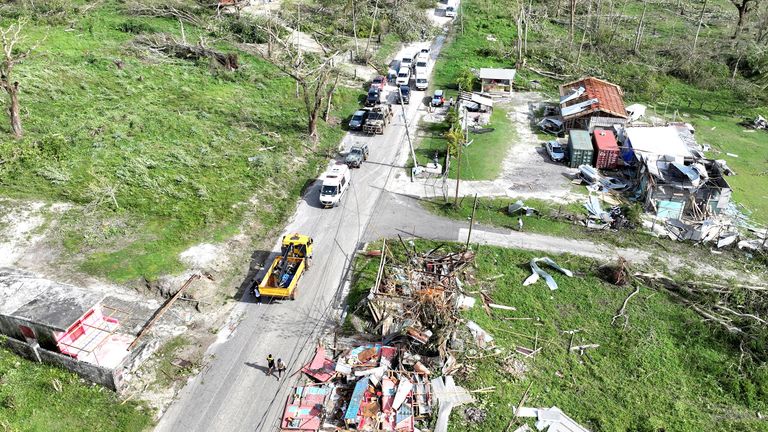
Further along the coast is the fishing village of White House.
Streets have been reduced to piles of rubble. Trees have been stripped of their leaves by the wind.
The west of Jamaica is the country’s bread basket, important for growing food.
But fields are underwater, flooded by up to a metre of rain that fell as the vast storm system passed over.
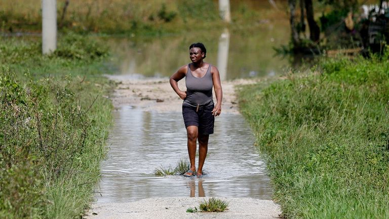
A woman walks after Hurricane Melissa made landfall, in Santa Cruz, Jamaica. Pic: Reuters
Pic: Reuters
Many crops will have been destroyed and the government has appealed for vegetable seeds so farmers can quickly plant crops again.
Read more:
What we know about…
[ad_2]


